MAGUS
SALE INQUIRY
SUPPORT REQUEST
INNOVATIVE, RELIABLE, COOPERATIVE
AUTOMOTIVE R&D PARTNER
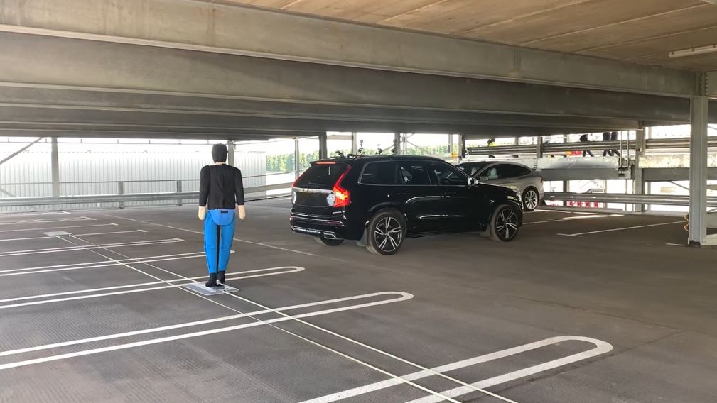
Automotive Measurement
Sensor & System
Autonomous Driving &
ADAS Test Solutions
General Test Consulting &
Vehicle Customization Rework
Indoor Positioning Syetem
Enhance accuracy in a GNSS-denied space using Pozyx ultra-wideband (UWB) as an aiding source
No GNSS? No problem
With the OxTS’ Pozyx 2GAD (to Generic Aiding Data) solution, you can enhance the data accuracy you achieve in your multi-storey car parks, tunnels, underpasses and other GNSS-denied spaces.

The solution enables real-time position updates, provided by a Pozyx ultra-wideband system, to be fused with your OxTS INS inertial measurements for improved navigation performance in the absence of GNSS signals.

HORIBA MIRA case study:
OxTS were presented with the challenge of finding an indoor localisation solution that could output accurate position data in the absence of GNSS signals, such as GPS, in the HORIBA MIRA car park infrastructure.

The solution would be used for the sole purpose of developing, validating and verifying AVP, Park Assist and other related systems.

The agreed upon solution uses ultra-wideband (UWB), from OxTS technology partner, Pozyx, as an aiding source for the RT3000 v3. UWB was the ideal candidate owing to accuracy comparable with camera and LiDAR at a cost comparable with Wi-Fi and Bluetooth Low Energy (BLE).
Key Components
There are four main components that enable the Pozyx 2GAD solution: Pozyx Anchors, Pozyx Tags, Pozyx Gateway and an OxTS inertial navigation system (INS) with Pozyx 2GAD option.
Pozyx Anchors
Anchors are a series of modules dispersed around the testing area.
Each anchor has a fixed, known position having been (semi-)permanently installed around the test area with their coordinates accurately surveyed.
A minimum of four anchors are needed to trilaterate position.
Pozyx Tag
Situated on the exterior of the vehicle.
Pozyx tags continuously transmit short pulses to the anchors.
The relative position of the tags to anchors, and the time-of-flight for each pulse, changes as the vehicle travels it’s route.
The time-of-flight measurements to each anchor are used to calculate the position of the tags within the space.
Pozyx Gateway
Combines and processes information from each of the Pozyx Anchors and Tags to deliver a real-time position upodates.
These real-time updates are then passed to the OxTS inertial navigation system to aid the navigation solution.
Technical Information
Performance (1) (2) (3)
Position accuracy (CEP) 3.5 cm
Velocity accuracy (RMS) 0.3 km/h
Roll/pitch accuracy (1σ) (4) 0.04º
Heading accuracy (1σ) (5) 0.3º

1. Accuracy of the OxTS INS is in reference to the Pozyx UWB system. Offset and bias introduced by the Pozyx UWB system cannot be measured by the INS.
2. Results were recorded in a Pozyx UWB environment area that had the positing algorithm optimised by Pozyx, with an estimated anchor
density of 10 anchors per 500 m2.
3. Valid with RT3000 v3.
4. Valid for flat surface.
5. Varies with dynamics.
Downloads
Brochure